Showing posts with label green corridors. Show all posts

Tuesday, 3 December 2024

Holderness: Hedon, Saltend and Marfleet

In today's walk, I took bus 75 to Hedon, and walked back towards Hull along the Withernsea railway train, which is now used as a cycle and pedestrian lane. At Hedon, I first visit the grounds of the impressive church, cathedral like. A Chaffinch feeds under a beech, and there are Jackdaws and House Sparrows around. I search for public rights of way to make my way to the railway trail, and I'm very pleased to find that they go along water. The map tells me that the town is surrounded by water: Reedmere Sewer, on the north and Burswick drain and Hedon Haven on the south side. I spot two Little Egret on the Reedmere, which, unlike its name, it's a transparent pleasant dyke. One of them flies to a tree overhanging the water (top shot). I take the trail near Twyers Hill and then it's a linear footpath, unpaved until the Hull boundary.

St Augustine's Church, Hedon
Singing Coal Tit.
Little Egret fishing at Reedmere Sewer.
Song Thrush.
The railway trail, lined by Hawthorn hedges.
Many shy Redwings flew in groups at my approach.
I only had a flock of Fieldfare.

A clump of trees looking north.
A Buzzard perched on a fence on a field before Staithes Road.
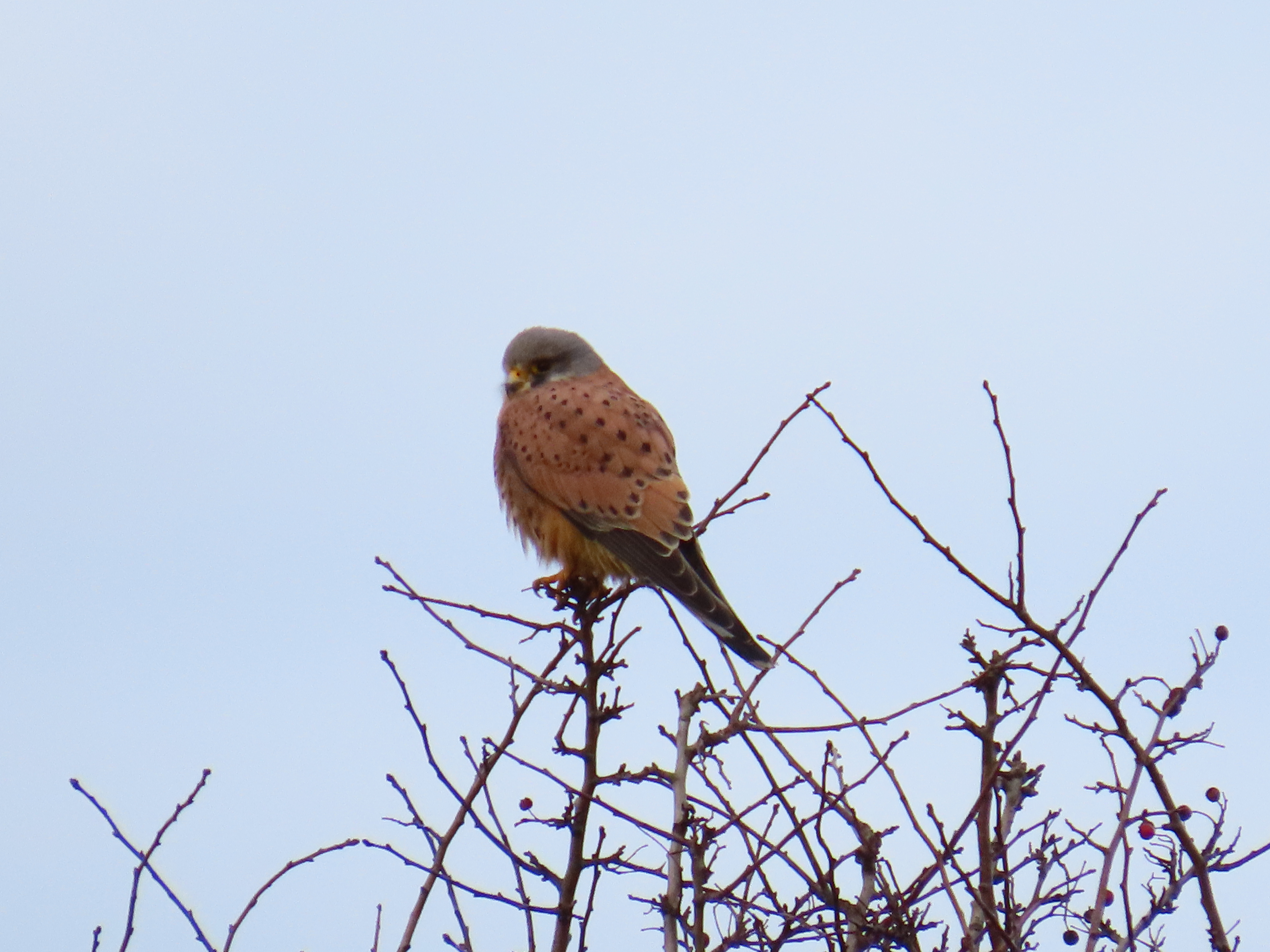
Kestrel.
The bubbling call of Curlews made me scan the field, the same where the Buzzard was. There were five Curlews overall, the Saltend power station towers behind them.
The Curlew field with the Saltend power station towers in the distance
I got lucky with this Redwing.
One of many Chaffinches today.
Goldcrest near Saltend.
Reed Bunting by the Old Fleet. 

A Meadow Pipit flew over this field inside the Hull boundary. It is a green space with paths, scrub and wetter areas. A female Kestrel was perched on the pylon visible. 
The trail is hard surface within the Hull boundary, but it retains its mainly hawthorn hedges and green corridor feel.

I take a short detour from the trail to visit what remains of the ancient village of Marfleet, now part of the city of Hull. Amongst large warehouses and industrial units and yards with mobile homes, stands a small church in a green churchyard with mature trees, which was the parish church of the village of Marfleet. At the time, Marfleet was a small agricultural settlement, with a few scattered farmhouses surrounding the church and right next to the grazing marsh of the Humber and large flat fields away from Hull. A common next to the high water 'Paddock common' and a brackwater is shown in the 1852 OS map. Today, a school and a few cottages and farmhouses, some refurbished dwellings, are all that remains from the old village. Marfleet is now separated from the Humber by the A1033 and King George Dock on reclaimed land.

St Giles church of Marfleet, rebuilt in 1883-4 in the same place as an older church.
A look into the wooded area known as The Lozenge.
I make my way to Holderness road at the end of the cycle track and catch my bus home. I will use Hedon as the start or end of other walks in the series, so I'll have the chance to explore other areas of the town.

Monday, 2 December 2024

Holderness: Sutton-on-Hull

The fourth stage of the Holderness series didn't involve any public transport. I just took the Hornsea Railway trail near home and walked along it to Sutton and Castlehill Aquagreen. It was cloudy and a bit drizzly to start with, but when I got to Sutton it was a beautiful sunny and calm morning. After the drainage of the marshy lands by the river, up to the early 20th century, low-lying fields stretched from the river Hull to Sutton. These were usually flooded in the winter due to poor drainage, but provided excellent summer pastures, which included Sutton Ings and Summergangs just south of Sutton. The city of Hull eastwards growth meant that it reached Sutton and the village ended up being part of the city in 1929, although still maintains a traditional village feel, with green spaces, plentiful mature trees, gardens and ancient footpaths such as Sutton Trod. It is a conservation area with several listed buildings, including Grade I listed St James' Church (top shot). Sutton-in-Holderness or Sutton-in-Hull is an ancient village named in the Domesday book, but in human use since Mesolithic times. It sits on a low hill, a rise of glacial till, 10 m over the sea level, which would have made it an ideal spot for a settlement, on dry ground rising over the tidal marshes, meadows and carrs (Sutton is surrounded by North Carr, East Carr, West Carr, now built up, and Risholme Carr), with easy reach for hunting and fishing. There is also historic evidence of the presence of wells providing fresh water.

The railway trail within Hull is a wonderful green corridor.
Twenty-four crows had something to resolve, they cawed and displayed atop some trees near Brackley Park.
Squirrels were busy burying food along the trail.
The section by Rockford fields and beyond has Turkey oaks, now glowing golden.
Just near Sutton, there is a well-wooded railway cutting, where I spot Goldcrest, Coal Tit, and Great Spotted Woodpecker amongst others.
Coal Tit.
Goldcrest.
Great Spotted Woodpecker
The railway bridge under Wawne Road, at Sutton. I leave the trail sortly after to visit Sutton.
The Old School, now Sutton and Wawne museum.
Adjoining cottages give a village feel to Church street.
Blackbird.
A surprise Red Admiral sat on a tree trunk on the church grounds.

Now onto the next part of the walk today. I follow the railway trail northeast and I'm soon in the outskirts of Hull. A set of fields, East and North Carr are still on the city boundary just south of Holderness drain. There has been some work done as part of the Holderness Drain Flood Alleviation Scheme led by the Environmental Agency on East Carr, with the Suttoncross Drain being realigned and enlarged, which enhances the ability of the land to retain water, enhancing flood defence and wildlife. Site access has also been improved.

 Suttoncross Drain realignment site looking northwest.
Moorhen and bullrush at the site.
A Grey Heron by the Holderness Drain.
Jackdaw at the Castlehill mound.
I sit on one of the new benches around Castle Hill mound to have my lunch. Half way through, whilst I watch a kestrel hovering in the distance, a sudden shower forces me to get my umbrella out. First time I have a picnic under an umbrella! I will have to pay a visit to this area in the summer.

Greenfinch.


Tuesday, 30 May 2023

A walk along Spring Bank West to Springhead Pumping Station


 Springhead Waterworks was built in 1862 to increase water supply to the growing city of Hull. The marshes where Hull was built and the river Hull were too salty for driking water, so freshwater from wells at the foothills of the Wolds at Anlaby, which included Julian's Well were used. This was piped, but had been by ditches earlier, and hence, 'Spring Bank' which led to the name of one of the main arteries of the city. Spring Bank runs almost straight from Springhead, at the westernmost edge of the city, to the city centre in its confluence with Beverley Road. Nowadays this makes a E-W green corridor that links the playing fields and allotments of Anlaby, through a green lane that includes the disused Hull and Barnsley railway tracks and sidings at both sides of Calvert Lane now rewilded, through to Stable Walk, and the Western and General Cemeteries. A large tract of Spring Bank West has a wide central reservation, likely a legacy of the old tram system, with a verge and trees which contributes to this green corridor.

It is a cold and cloudy morning. I walk west from home making my way to the Pumping Station alongside Spring Bank, and the parallel path just W of Calvert Lane, a brownfield site with birch and meadows. Bird's foot trefoil is blooming. Blackcaps and Chiffchaffs sing, a Fox scuttles ahead into the verges.

A displaying collared dove, bowing and stretching, and doing some footwork in between


The southern path along the western sidings off Calvert Lane. The brownfield that were the disused railway tracks of the Hull and Barnsley railway are now wooded, mainly with birch, and have an interesting flora.

A meadow with flowering Pignut off the railway sidings


I finally get to the Springhead Waterworks. There is a public footpath around it, but the fence and hedges around it makes it hard to get good views.

Behind the waterworks there is a ditch, the Sand Dike, running south-north to the confluence with the Setting dike.
The football pitches just south of the waterworks were teeming with rabbits, I counted 20, many of them young.
Woodpigeons and rabbits on the playing fields.
The waterworks octogonal tower.
The very pleasant Spring Bank West green lane.
Grey Squirrel feeding on a male pine cone.
This Chaffinch sung while sitting on a branch, maybe something wrong with its feet?

One of the ten Swifts flying over Spring Bank West, the highest number I've seen this year.