Showing posts with label Lake. Show all posts

Monday, 26 May 2025

Holderness: Ottringham, Keyingham, Burstwick and Hedon

 I take the 8:10 bus to Withernsea and at 9:00 I am at Ottringham. It is a sunny, but breezy day. I walk around the small village and church. A few Swifts and House Martins fly above, while a Greenfinch sings from an aerial. I retrace my steps and walk along the to take a track, Fields Close Road, which takes me to the Withernsea railway trail. A stretch of road is lined by maples, with hawthorn and ash hedges. A Yellowhammer and a family of Great Tits along the way. Skylarks sing. The disused railway track has an open aspect, with Birds foot trefoil and lots of rabbit holes. It must be quite a challenge to cycle it, and I did come across a cyclist and a horse rider. Many birds are feeding young, and alarm as I walk past. A Whitethroat and a House Sparrow with bills full of insects stop on trees to keep an eye on me. I hear a Yellowhammer, but I struggle to find it, until I realise it is singing from the ground at the edge of the field, keeping away from the wind. The landscape is quite flat, with ditches and hedges. A Buzzard flies over. I see five Buzzards in my walk today, including a pair flying together.

Greenfinch.
Jackdaw.
St Wilfrid's Church, Ottingham.
Great Tit.
Looking back at Fields Close Road
Looking North across the Withernsea railway track.
Yellowhammer singing from the ground.
Whitethroat with food.
Male House Sparrow with food.
Green-veined White.

As I arrive at Keyingham, I note that the railway track has a gap that has been converted to private gardens. A big board announces that it is a Private Garden, no tresspassing! As the station was sold and converted into a private house, it took with it the land of the railway track, sadly. There is a detour north, but the walk around the village is more interesting, so I walk south along Eastfield Road and then make my way to St Nichola's Church. The church and green are in a rise, as many are, but not at the highest point of the village, about 17 m, which is the location of an old wind mill, at Mill Lane.

Rook at Keyingham.
Displaying House Sparrow.
St Nicholas' Church, Keyingham.
The Mill, Keyingham.

There is a lovely view of a shallow, flat valley as I carry on out of the village towards the NW. The hills around the area are the remains of ancient postglacial moraines, and the sand and gravels that form it have been exploited in quarries, which are now filled with water. The lakes of Kelsey Hill are the flooded quarries that supplied ballast to build the railway line, and the railway line started to be laid in the area. The quarrying revealed remains of ice age mammals, like mammoth, reindeer and the very well preserved bones of a Walrus, indicating that the hills were then islands on a shallow, cold sea, were found in the quarries of these hills. I cross Keyingham Drain by a footbridge and then walk along it to join the railway track briefly. I scan the fields north of the track and spot a Lapwing and a Hare. Then I follow the public right of way across Kelsey Gardens, where I stop for a hot drink by the cafe by the lakes. A Sedge Warbler and a Willow warbler sing. A family of Mute Swans feeds by the shore, and in the distance I spot a Great Crested Grebe. The grounds are wooded and there are two lakes.

Looking north from Mill Lane.
Footbride across Keyingham Drain.
Footpath across a wheat field.
A view of Keyingham Drain from the railway bridge by Kelsey Hill
One of five buzzards seen today along the walk.
Great Crested Grebe.
The Mute Swan cygnets gather around their mother as she pulls plants from the bottom...
...and then they rapidly pick whatever she has brought to the surface.
Four Spotted Chaser.
It's a good day for butterflies, as they settle on the ground to avoid the wind. A Red Admiral here.
Small Tortoiseshell.
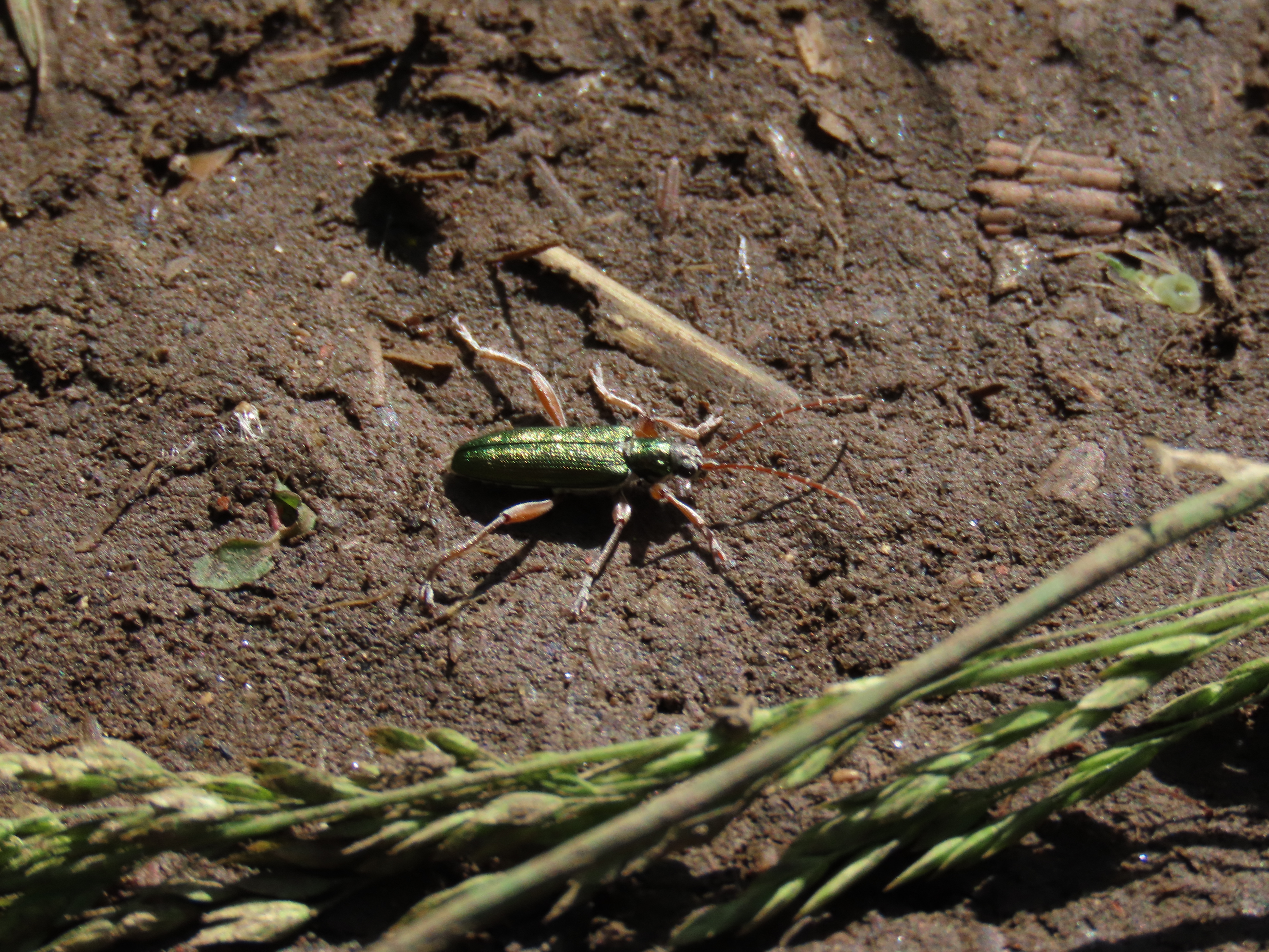
A Red Cardinal Beetle about to fly off.

I find the footpath leaving Kelsey Gardens and walk along the track along East Carr Drain towards Burstwick. A Kestrel and a Buzzard. It has got cloudier and more humid. A Yellowhammer takes a bath on the drain. I made my way across Burstwick and follow the track by Burstwick Drain. I notice my first singing Reed Buntings, more Skylarks and Yellowhammers. As I get to the outskirts of Hedon it starts to rain. Burstwich Drain crosses Hedon and has footpaths alongside it. It is very well vegetated and a green corridor in the town. The footpath is very overgrown in places, which means my trousers are soon drenched. I walk towards the town centre along Love Lane. I am a bit early for the bus back to Hull, so I walk around the church and get my lunch. A Sparrowhawk fly over wreaks havoc among the Feral Pigeons, who fly around the church. As I wait for the bus I notice a Jackdaw landing just below a Herring gull. It looks at its tail and before I can take another photo it has jumped and pulled the gulls tail! They find big birds tails so irresistible. What a great way to finish this lovely walk.

Kestrel.
Swift.

A chapel at Burstwick, the former Methodist church, which lost its spire in 2007.
Burstwick Drain.

Burstwich Drain at Hedon.
St Augustine Church, Hedon.
Jackdaw Watching the gull's tail.
Today's walk route.


Sunday, 19 May 2024

Sunny walk around Oak Road lake

A sunny, warm morning, I head towards Oak Road, hoping to see if the swans have cygnets. I briefly pop in the Barmston Drain at Beresford avenue, but is a very spiky and almost impregnable jungle of nettles, creeping thistle and hogweed, so I soon have to turn round. A very old and faded Small Tortoishell basks near the Oak Road playground. The water around the lake is high, but has receded enough so that the south path is walkable without wellies. I walk slowly hoping not to flush insects basking in the sunny side of the wood. I'm not disappointed, a fresh Broad-bodied Chaser, and then another are basking and hunting by the path (top shot). Later, in the same area, a Banded Demoiselle. Blue-tailed Damselflies and Azures complete the dragonfly list. There are plenty of the later two, which bodes well for the year at Oak Road. 

I start walking counterclockwise around the pond when a sound stops me in my tracks, a Marsh Frog, unmistakably calling from near the metal bench. I take some recordings and try to spot it, but it is in the reedbed and I can't see it. Another one is calling from the other side of the pond, and a Cetti's Warbler joins in. Hard to think that we are not at Tophill Low!


Broad-bodied Chaser.
Azure Damselfly.
Mating Blue-tailed Damselflies.
Donacia clavipes a beetle inhabiting reed beds.

The swans have indeed cygnets, eight altogether and they are taking them to food. I meet a dog walker on the river bank taking a detour from the lake footpath after the cob threatening display by his cygnets.

The damp areas around the pond are good habitat for the Slender Groundhopper.

The swan family.

This was the final surprise of the morning, a Banded Demoiselle basking on the south side of the wood.

Monday, 25 March 2024

Last interglacial coast trail. Stage 4: Scorborough to Hutton Cranswick

Although the sky is overcast and the weather forecast threatens light showers, I get the 8:31 bus to Scorborough. It’s strange to think that Scorborough had its own beach in the last Interglacial. Now, the little village with a long history sits by a lovely beck and has an impressive church and parkland. I take a walk around the village before starting the stage proper. Scorborough Beck passes under the Driffield Road via a three arch brick bridge. There seem to be many water vole burrows, but they could be old, I see no other signs of activity. The Rooks are in full swing from their nests on large Oaks on Scorborough Park. A Great Spotted Woodpecker drums.

Scorborough Beck.
Scorborough Beck.

Two views of Scorborough Park.

Time to start walking the route. The first stage involves crossing a couple of arable fields. I check with my binoculars to aim for the yellow arrow of the public right of way, as the paths are not well trodden and there are no footprints across the crop. Skylarks sing and a pair of Red-legged Partridges run away in the distance.

Red-legged Partridges.

The route follows the Minster Way until Cawkeld Sinks. The following fields are very low-lying, with rushy springs, and squelchy to walk on. Some impressive willows lay spread on the field boundary. I get distracted and end up on the wrong side of Bryan Mills Beck. It’s quite shallow and narrow and I briefly consider taking my shoes off and just crossing it, but I end up turning round and crossing the plank bridge. Ahead, by the beck, a nervous Grey Wagtail watches me.

Rushy, wet fields with willows.
The sprawling willow.
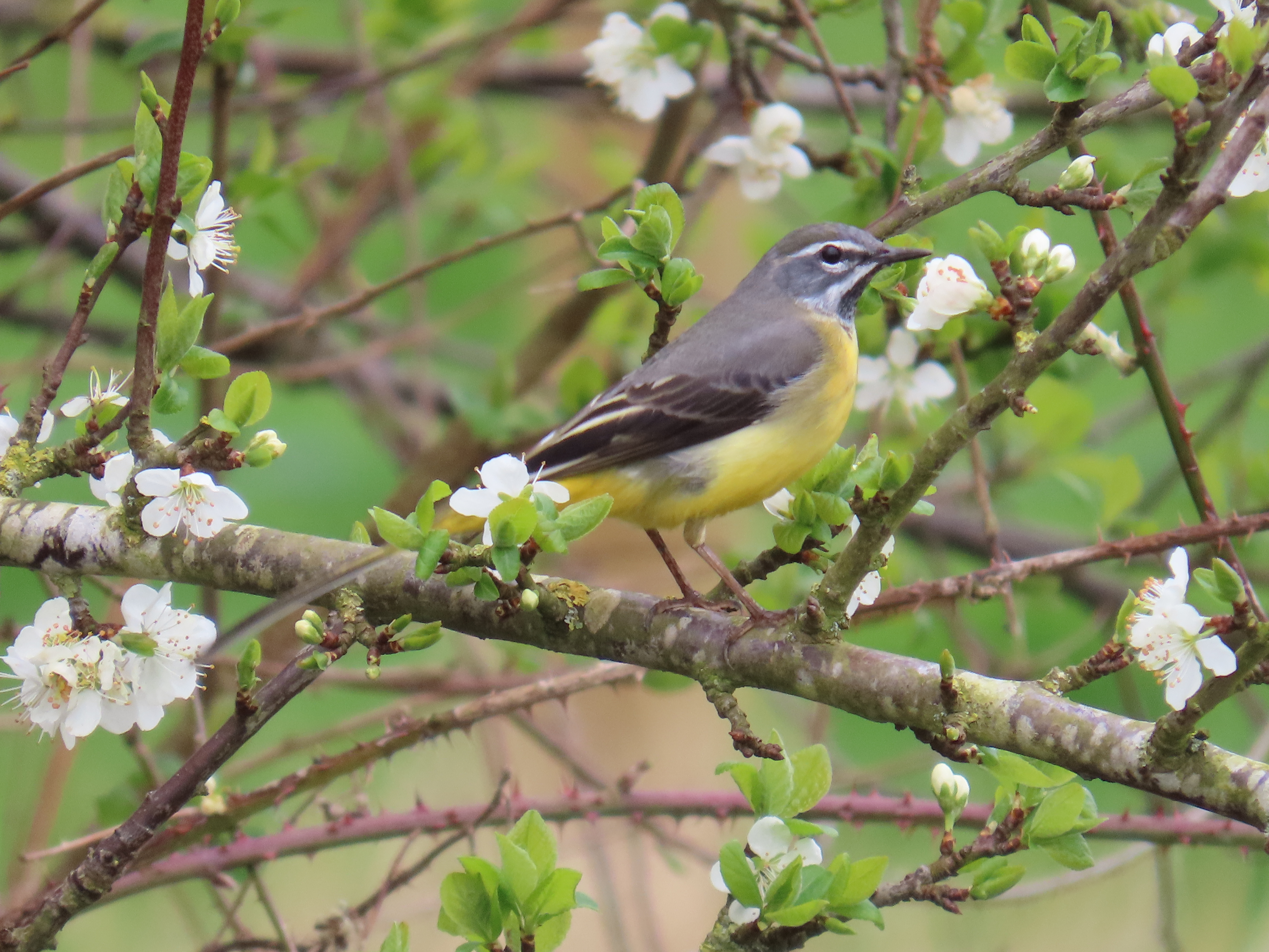
Grey Wagtail.

At Lockington, I walk by St Mary’s church, flanked with some large yews, and follow through the village, cross a bridge over Brian Mills and as I walk along Front street, I’m delighted with its several fords (at least three!). I leave the village, and the valley of Brian Mills Beck on a quiet lane, Pit Lane with a noticeably uphill.

St Mary's Church, Lockington.
Brian Mills Beck from the bridge.
One of Lockington fords.

The route is now almost due north, by arable fields and plantations. Three Buzzards soar over Southbelt Plantation, Skylarks chase on the fields, a Yellowhammer sings from the hedge. I soon get to Kilnwick, and its beck, Kilnwick beck, which is upstream of Watton Beck valley. 

All Saints Church, Kilnwick.
Rook.
It is a broad, quite wooded valley with several streams and springs, crisscrossed with public rights of way. A bit higher up I come across Cawkeld Sinks, a lake with an island in very boggy terrain, it's a pocket of blissful wilderness. Even though today’s walk aim is to re imagine Brown Bears in the last interglacial, this area looks instead set to introduce Beavers: the lake vegetation is overgrown, with poplars laden with mistletoe, and willows, and island and fallen trees (top shot). Gadwall, Little Grebes and Moorhen are in the lake. 
Kilnwick Beck.
Gadwall.
Poplars with mistletoe.
Wood on the ground.
A boggy spring at Cawkeld Sinks.
Red Kites.
On a plantation nearby two Red Kites sit atop a spruce. The trees growing in Cawkeld chalk pit, and the wooded boggy area I just walked across make me think that it is mostly chalk pits and springs that are wooded in the midst of intensively arable land in the area: the former because the top soil was removed and there is uneven ground, which is no good for arable, therefore the vegetation has naturally colonised, the latter as they are surrounded by boggy terrain, no good for arable and too small for pasture.

I leave the Minster Way now, aiming for Hutton Cranswick. It starts to drizzle, and I’m around an hour away from Hutton Cranswick so I press on, walking by Burn Butts Farm and the evocatively named Bustard’s Nest Farm and Little Bustard Farm. As I get to Hutton Cranswick, I watch a pair of Lapwing on a field.

An extensive arable field near Bustard Nest Farm.
There used to be Great Bustards in the Wolds, maybe even on the grounds of this farm, which had the same name in the 1st edition of the OS map in 1852.
Little Bustard Farm.
Lapwing.

I get my lunch at Cranswick Farm shop. Afterwards, as I make time for the 15:04 bus, I walk to the Cranswick village pond, which will be the start of the next walk.

The village pond at Hutton Cranswick green.
There has been a lot of water in today's walk: bogs, becks, lakes and ponds. In the interglacial, the warmer climate allowed European Pond Turtle to colonise England. We can only imagine the diversity of dragonflies that would be present during this time.
Plenty of fresh molehills, rabbits (from the bus) and Roe Deer prints make the mammal list of the day.
My Brown Bear sketch.

Brown Bear

The extant Brown Bear, Ursus arctos, from the northern hemisphere was the same species that inhabited England during the Ipswichian. Unfortunately, there are few securely dated UK fossils. These include some from Barrington, Cambridge, and Cefn Caves in North Wales. A young bear jaw was reportedly found at Sewerby buried cliff, but the specimen is now lost, and that is the only East Yorkshire fossil from the Ipswichian I’ve been able to find references to. The Brown Bear needs little description, it is a large omnivore, and in the last interglacial it would have roamed across all lowland habitats, not just restricted to mountains as it is now. The Brown Bear has the broadest diet of any bear, and tends to exploit abundant, easy to find prey in an opportunistic way. It would have moved onto rivers to catch salmon during migration, it would have been at ease in woodland, to feed on acorns, beech mast and root around the woodland floor for grubs or nests, or wandered along the coast to take advantage of clams, crabs or carrion on the shoreline. Young deer or other mammals could have been predated opportunistically.

A Brown Bear skull from Creswell Crags.
Where can I see them?

Brown Bears survived in glacial times and recolonised England very quickly after the last glacial maximum suggesting that they might have persisted in the unglaciated southern England. It is unlikely that they made it in a wild state beyond Roman times in the UK, although captive individuals were imported for bear-baiting until medieval times. In mainland Europe, Brown Bear populations managed to persist in mountainous areas of South and Eastern Europe and Scandinavia and since the 60s, they have increased due to better protection and reintroductions. There is no evidence that Cave Bears, a different species, lived in the UK during the Ipswichian, but today's Brown bears have a little Cave Bear ancestry in their genomes.

Walk details. Distance: 12 km. Bus 121 to Scorborough, at 8:31. bus back from Hutton Cranswick (8 min past the hour). Some muddy paths, country lanes and arable fields. The maximum height is 42 m near Burn Butts farm, the minimum 8 m.

More information
Barnett, R. 2019. The Missing Lynx: The Past and Future of Britain’s Lost Mammals. Bloomsbury Publishing, 2019.
Barlow, A. et al. 2018. Partial genomic survival of cave bears in living brown bears. Nat Ecol Evol 2, 1563–1570 (2018).