Showing posts with label Last Interglacial trail. Show all posts

Monday, 27 May 2024

Last interglacial coast trail. Stage 8: Bridlington to Sewerby

Today is the last stage in the Interglacial coast trail, a circular walk, the main stretch is via the streets of Bridlington, then descending at Sewerby steps, and returning by the beach. The weather forecast threatens storms at lunch time, but fortunately there are only a couple of short, light showers and it is altogether a pleasant day, though windier in the afternoon.

I get to Bridlington station at 9:00 am, and take Bessingby road and then St Johns Avenue. I can see Bessingby Hill in front of me. In the last interglacial this stretch of the coast would have been tricky to cross, with the small Gypsey Race haven surrounded by marshes and pools. At low tide sand banks and shingle bars might have allowed passage across. There is a small stretch of the Gypsey Race visible from St John's Walk, a straight, embanked and gated stream. The final part of the stream was only daylighted recently to make the Gypsey Race park, and it has been heavily managed since historical times, with four watermills and mill ponds directing its waters to grind flour and bone, cut wood andeven produce electricity.

Gypsey Race near the station.
Jackdaws and a Herring Gull share these chimney pots.
This Herring Gull's nest is protected by a watchful plastic owl.
High Street at Bridlington Old Town.

The remainder of the walk to Sewerby is uneventful. Swifts, Swallows flying over, Jackdaws and Herring Gulls on nests on roofs. A light shower at Sewerby, then the sun shines and I have a snack at the top of the Sewerby steps. Afterwards, I descend to the beach.

House Martins collecting mud for their nests from a wet spot on the glacial till.
Oystercatcher.

The tide has turned and is now ebbing. An Oystercatcher catches something large and a Herring Gull pursues it until I lose them from sight. A large flock of House Martins pick mud on a steep slope atop the cliff, from the glacial till. There is a population of House Martins in Flamborough that nests on the cliffs themselves, probably the ancestral nest sites for the species before they discovered houses. There is a spring at the beach, and it is a busy spot with Kittiwakes and Herring Gulls taking baths. The Kittiwakes are picking bits of seaweed and dropping them, some fly off with them, they are building or repairing their nests. Some Sandwich Terns pass by, tempted to land with the gulls, but deciding to carry on fishing.

Kittiwakes and Herring Gulls bathing and preening.

Sandwich Tern

There is a lot of water seeping out of the gravels along the cliff as I walk towards Bridlington. A forest of Great Horsetails grows on the wet slopes down to the tideline. There is a little rivulet where tufa forms platforms and shallow little pools where birds often gather to bathe. Today two Greenfiches and a Whitethroat were on it. It's busy at the sea front, being Bank Holiday. I wander around the harbour for a while and then I get to the station to catch my train back.

A male House Sparrow in front of Great Horsetails.
Greenfich.
Whitethroat.
Bridlington has a busy colony of Kittiwakes, their nests are on eaves, windowsills and any narrow shelves on buildings.
Many are flying to the beach and gathering bits of seaweed to repair them.

Sewerby Palaeobeach exposure.

The Sewerby buried cliff

By the bottom of Sewerby steps is Rock Ends, where the chalk platform at the bottom of the cliffs gives way to North Sands. On the cliff itself, the chalk is replaced by glacial tills and gravels. The Sewerby paleo beach exposure is in the junction between chalk cliff and till and gravels. Unfortunately, the exposure is not very obvious today, recent rains have caused slips and much of the chalk is covered on mud. A bit of blown sand and chalk rubble is visible, but no beach shingle. Some of the raised beach formed by chalk shingle might be visible if you are lucky, higher than the current high water mark. Sands covering this paleobeach, from ancient dunes, have been dated from the Ipswichian, 120,000 years ago. This site, together with Hessle, is the only in East Yorkshire where the interglacial cliff emerges from its covering of glacial till and gravels. It is not only a geological site but an important palaeontological site.

The fossils

Fishermen had found fossils at the base of the Sewerby cliffs since the beginning of the 19th century, including the tusk of a straight-tusked elephant. After winter storms cleared the clay covering the exposure, Mortimer in 1884, alerted by Lamplugh, did some searching in the area and found bison bones. Later, Lamplugh organised an excavations with a budget of £10 of the time, in 1887. Altogether, the megafauna fauna identified from the fossils found at Sewerby, which was later revised by Boylan, is typically Ipswichian and include Cave Hyena, Bear, Straight-tusked Elephant, Narrow-nosed Rhino, Hippo, Giant Elk, and Bison.

Straight-tusked Elephant

The herd had been feeding all morning deep into the wooded pastures on the Flamborough headland, and are now marching towards the stream to drink. They follow a well-trodden track that runs roughly along where the B1255 road to Bridlington is now, avoiding the steep ravine of Danes Dyke. The matriarch, the largest and oldest elephant, distinctive for the missing tip of her right tusk, leads the way. She is sniffing the air for lions or hyenas, but doesn’t seem too anxious. The track now opens up on the valley bottom, into a grassy damp meadow, the work of the pod of hippos, which is now wallowing and snorting on the shallows of the Gypsey Race Haven.

Given the popularity of elephants, it is puzzling that the Straight-tusked Elephant, Palaeoloxodon antiquus, is so neglected compared to the other extinct European species, the Woolly Mammoth. The Straight-tusked Elephant was one of the largest terrestrial mammals to have existed, with individuals reaching over 4 m in height at the shoulder and males weighing up to 13 metric tons. It had - you guessed! - relatively straight tusks, and this was an easy way for palaeontologists to tell fossils of this species apart from the Woolly Mammoth, which had strongly curved tusks. Several molars and tusk fragments were found in excavations at Sewerby Cliff. Notably, there are little or no cave paintings that can represent Straigth-tusked Elephants, contrasting with a rich portable art and mural representations of Woolly Mammoths. A detailed reconstruction in a recent article by Larramendi and colleagues shows what the elephant might have looked like, which was reproduced as an Eofauna model depicted in the photo above.

The Straight-tusked Elephant was closely related to African Elephants and inhabited Europe in the last interglacial. It thrived during interglacial periods across Europe as far north as Yorkshire in the UK, and retreated to the Mediterranean during glacial periods. Both Mammoth and Straight-tusked Elephants coexisted in the transition periods between glacials and interglacials. It inhabited deciduous woodlands or Mediterranean evergreen woodland, as opposed to the cold-adapted, open steppe or tundra of the Woolly Mammoth. The pattern of tooth wear indicates that it was a browser, rather than a grazer. A very interesting feature of the straight-tusked elephant is its mixed ancestry: it is closely related to the extant African elephants, but it has some ancestry from the Woolly Mammoth and African Forest Elephant too.

The tip of a tusk of a Straight-tusk elephant excavated from Sewerby in 1879, that can be seen at the Hull and East riding Museum.

Straight-tusked elephants would have lived in multi-generational matriarchal herds with young. The adult males would leave the herd and join others forming bachelor herds, or become solitary, like living African elephants today. The species was hunted across Europe by several human species during the last half million years. In the last interglacial it was regularly hunted by the Neanderthals in mainland Europe. In human-free Britain, the Straight-tusked Elephants of the last interglacial didn’t have to worry about humans, only Cave Lions or Cave Hyenas might have posed a risk to young individuals, as evidenced by the finding of milk molars belonging to Straight tusked Elephant young in Kirkdale and Victoria caves, likely predated by hyenas.

East Yorkshire museum diorama of a herd of Straight-tusked elephants by the Flamborough Cliffs.

Can I see them?

Unfortunately, Straight-tusked Elephants went extinct during the last glaciation, about 37,000 years ago, probably because the populations in the Mediterranean refugia at the height of the glaciation were small. There was little overlap with the newly arrived modern humans, but it’s possible that hunting by modern humans might have caused their ultimate demise. You can see a real fossil tusk of a Straight-tusked Elephant from Sewerby at the East Riding Museum in Hull, or you could follow the Elephant Trail along Albany Street and Spring Bank West in Hull.

Walk details. Distance: 9 km circular trip. From Bridlington train station walk north along Bessingby Road and then turn right at St John's Avenue and then to Brookand Road. Take a right to High Street and continue towards Bridlington Priory Church, leave the church on your right and continue along Sewerby Road to Sewerby Village. There are refreshments and public toilets in Sewerby Hall (free access in the winter season, but entrance fee in the summer, check website for details), several along North Beach, and at the train station. The return is descending the Sewerby Steps, and walking back along the beach, harbour, and the Gypsey Race Park to the train station.

More information

Boylan, P. J. The Pleistocene Mammalia of the Sewerby-Hessle buried cliff, East Yorkshire. Proc. Yorks. Geol. Soc. 36, 115–125 (1967).

Boylan, P. J. A new revision of the Pleistocene mammalian fauna of Kirkdale Cave, Yorkshire. Proceedings- Yorkshire Geological Society 43, 253–280 (1981).

Lamplugh, G. W. Report on the buried cliff at Sewerby, near Bridlington. Proc. Yorks. Geol. Soc. 9, 381–392 (1887).

Stuart, A. J. The extinction of woolly mammoth (Mammuthus primigenius) and straight-tusked elephant (Palaeoloxodon antiquus) in Europe. Quat. Int. 126-128, 171–177 (2005)

Larramendi, A., Palombo, M. R. & Marano, F. Reconstructing the life appearance of a Pleistocene giant: size, shape, sexual dimorphism and ontogeny of Palaeoloxodon antiquus (Proboscidea: Elephantidae) from Neumark-Nord 1 (Germany). Boll. Soc. Paleontol. Ital. doi:10.4435/BSPI.2017.29.

Moss, Cynthia (1988) Elephant Memories: Thirteen Years in the Life of an Elephant Family. Harper Collins Publisher.

Palkopoulou, E. et al. A comprehensive genomic history of extinct and living elephants. Proc. Natl. Acad. Sci. U. S. A. 115, E2566–E2574 (2018).Braun, I. M. & Palombo, M. R. Mammuthus primigenius in the cave and portable art: An overview with a short account on the elephant fossil record in Southern Europe during the last glacial. Quat. Int. 276-277, 61–76 (2012).

Monday, 20 May 2024

Last interglacial coast trail. Stage 7: Burton Agnes to Bridlington

A cool start of the day, overcast. I get to Burton Agnes at around 10am and start climbing the road towards Rudston Beacon. This is a quieter road, but there is traffic, every few minutes throughout the walk. I walk by Burton Agnes Hall and then by a playing ground, that has a motley crew of birds: two Red-legged Patridges chasing, a Mistle Thrush family, many young and adult Rooks, a pair of Oystercatchers and Woodpigeons.

Red-legged Partridge.
Oystercatcher.
Young Mistle Thrush.

I'm soon by a small copse and look back towards Burton Agnes.  As I pass the copse I see some dark birds with Pheasants in the distance and I realise they are Guineafowl.

Looking back towards Burton Agnes from Stone Pit Plantation.

Guineafowl and Pheasants.

The last interglacial coastline

From Burton Agnes to Bessingby Hill at Bridlington, it is likely that the coast would have been linear, with 30 m high cliffs, similar to those at Sewerby, only to be broken by the wide Great Wold Valley with the tidal Gypsey Race meandering to the tideline. The now unassuming Gypsey Race was probably the largest river after the Humber, as the River Hull wouldn't have existed at the time. The bottom of the cliff line roughly overlaps the train line, and the busy A614 is only a bit higher and parallel to it, but it is far too busy to walk along, so today's main part of the walk follows a quieter clifftop path: Woldgate. Woldgate is a now a single track road that follows part of an ancient route, used by the Romans to travel between York and Bridlington, although Woldgate as such is the stretch from the east of Kilham to Bessingby Hill on the west of Bridlington.

I'm at Burton Agnes Field, an open slope of arable fields either ploughed or green and growing, often lined with overgrown hedges of flowering Hawthorn. A weak trill comes from a hawthorn ahead: a Corn Bunting! I count 5 singing males in a short stretch, what a lovely surprise!


I spend a while trying to photograph this lump of earth in the shape of a rabbit.
Pied Wagtail.
Another Corn Bunting singing away.

I'm very pleased to realise you can see the sea from Burton Agnes field, the first time since I watched the Humber at Hessle that the distant modern coast is visible. I reach Woldgate and turn right. The mostly flat  area is peppered with tumuli or round barrows from the Neolithic or the Bronze Age and nearby there are the remains of a Roman Villa, with an impressive leopard mosaic that can now be viewed in the Hull and East Riding Museum. Shortly after I'm at Rudston Beacon, the highest point in the walk at a mighty 92 m. Woldgate follows a ridge on the Wolds, allowing sweeping views north and south: I can see the sea looking south east, but also the Great Wold Valley looking north. This rural, quiet landscape (barring the passing traffic!) inspired artist David Hockney, who lived in Bridlington from 2004 to 2013. The seasonal changes in hedges, green and yellow fields, the Cow Parsley and Red Campion on the roadside verges and the plantations all feature in his bright and bold paintings that are collected in his book A Bigger Picture

After crouching trying to disappear into the grass, this cock Pheasant stood proud, bright and bold.
Occasional older trees pepper the road before Sands Wood. 
The view looking north towards the Great Wold Valley.
One of the several Yellowhammers seen.
The sea is visible until Sands Wood.
The start of Sands Wood. 
Sands Wood

It's past midday and I'm ready for my lunch. I find a track in the wood and sit down to eat. Afterwards, I spend some time inspecting the trees for snails. I first visited this wood in a memorable trip in September 2016 with my friend Rob Jaques and expert conchologist Adrian Norris. Adrian introduced me to the snail fauna of th earea, including the Lesser Bulin, which I quickly find. It was nice to spot them again in the same site.

Merdigera obscura, the Lesser Bulin.
A tunnel in the woods.
A section of Fond Brig, part of a folly at Bointon Hall grounds.

After Fond Brig between Hallowkiln Wood and Fish Pond Wood, Woldgate turns gently as it descends the ridge towards Bridlington. I think about ancient walkways and up to what point people might have followed similar routes that extinct megafauna took, perhaps elephant tracks carved onto open, light wooded landscapes, taking advantage of this ridge with good visibility to keep an eye on predators and solid ground away from mires and bogs.

Not much further I spot some Sanicle by the roadside, an indicator of ancient woodland. It is likely that the plantations in this area have been wooded since ancient times.

Bridlington Priory Church is visible across the Great Wold Valley. 

Woldgate ends at Bessingby Hill by the A165. I cross the road and walk along it for a short stretch before turning left onto Bessingby Road and I'm soon at the station to get my train back home.

The Gypsey Race near Bridlington Railway Station.

My ink drawing of a Narrow-nosed Rhino. I used as a reference a Sumatran Rhino, its closest living relative.
Narrow-nosed Rhino

The Woolly Rhinoceros, Coelodonta antiquitatis, is a well known extinct species that inhabited Europe during Glacial Periods. During interglacial times in the last half a million years it was replaced by the Narrow-nosed Rhinoceros, Stephanorhinus hemitoechus. This was a large animal, about 2 m tall on the shoulder. Their short legs and low and narrow skull pointing downwards suggest that it was a likely grazer, so it was probably associated with open habitats. However, analysis of the wear patterns of teeth including Yorkshire fossils, revealed that its diet was likely mixed, including some browsing. Both studies on ancient DNA extracted from fossils and morphological features support that the closest living relative of the Narrow-nosed Rhino is the critically endangered Sumatran Rhino. Yorkshire Narrow-nosed Rhino fossils have been found in Kirkdale Cave, Sewerby Cliff and Victoria Cave. Cave Hyenas would have been predators or at least scavenge them.

Can I see them?

During the last Ice Age Narrow-nosed Rhinos distribution contracted to southern Europe, and eventually the species became extinct around 42,000 years ago, coinciding with the arrival of Modern Humans to Europe, but also with an intensification of cold conditions. Skeletal morphology and sequencing of proteins supports that the narrow-nosed rhino was closely related to the extinct Woolly Rhino and the Critically Endangered Sumatran Rhino, the smallest and most hairy of the five species of extant rhinos. Sumatran rhinos are solitary and live in dense tropical forests and are browsers. They are currently not kept in zoos, but there is semi-captive breeding in Indonesia, with some recent success, although the species is thought to comprise fewer than 80 individuals in the wild.

Walk details. Distance 12 km. Train to Driffield, then bus 121 to Burton Agnes. Return to Hull by train from Bridlington. Public toilets and restaurants at Bridlington. The walk is on surfaced roads and pavements once near Bridlington. The highest point is 92 m at Rudston Beacon, and the lowest 10 m at Bridlington Station.

More information

van Asperen, E. N. & Kahlke, R.-D. Dietary variation and overlap in Central and Northwest European Stephanorhinus kirchbergensis and S. hemitoechus (Rhinocerotidae, Mammalia) influenced by habitat diversity: ‘You’ll have to take pot luck!’ (proverb). Quat. Sci. Rev. 107, 47–61 (2015).

Welker, F. et al. Middle Pleistocene protein sequences from the rhinoceros genus Stephanorhinus and the phylogeny of extant and extinct Middle/Late Pleistocene Rhinocerotidae. PeerJ 5, e3033 (2017).

Tuesday, 14 May 2024

Last interglacial coast trail. Stage 6: Driffield to Burton Agnes

A light, low cloud, not even a fog in the morning. It is a bit breezy but mild. I take the 8:21 train to Driffield. As I step out of the station, I see Swifts chasing and screeching. I walk by River Head, heading east. 

The Water Forlorns, the feeder for the the Driffield Navigation.
The beautiful mills at Riverhead the beginning of Driffield Navigation.

The buried cliff follows the railway line closely and the beginning of the walk can easily follow it, a footpath by ongoing housing developments on the outskirts of Driffield. Two Roe Deer browse on the edge of a field. They look a bit shaggy, shedding their winter coat. Shortly after, at Marksman Lane, after walking by bright drifts of Red Campion, I find a herd of eight hinds and a buck on a field. It's the largest group of Roe Deer I've seen. I often see Re Deer from the train on this area, so it's nice to watch them, unbothered by my presence. A few Rabbits feed on the edge of the same field. 


The whole herd of Roe Deer.

Some of the Roe Deer appear to already have their short, reddish, summer coat, the shaggy ones keep licking their flanks, looking itchy and uncomfortable.

The sun starts breaking the clouds. Typical landscape of the Wolds.

I see a raptor and think it's a Marsh Harrier, but it banks and shows its white rump, a Hen Harrier, it promptly disappears behind the overgrown hedge and I don't see it again. 

All Saints Church.

I'm in Nafferton. Swifs chasing and Swallows. Jackdaws and busy Starlings. A lone House Martin. The imposing church, on a rise looks over the large village pond, Nafferton Mere, previously Mill Pond. A spring feeds the pond. I walk along the side street looking for gap in the houses and a clear view. The water is clear, showing many aquatic plants. There is a busking cob Mute Swan chasing the Mallards. The female is probably hidden on her nest.

Nafferton Mill Pond, looking East.

I leave the village by Lowthorpe Lane, bounded by high flowering hedges, Orange Tip males flying up and down the lane. A colony of Tree Sparrows is a nice surprise. A Whitethroat sings from an overhead cable. I spot a very distant Brown Hare on a ploughed field. It is a great day for mammals!

Young lambs by Backcarr lane.

Tree Sparrow.
Whitethroat.
Looking east towards Lowthorpe.

I hear a wagtail calling from a small ash. I'm underneath it but to see it, I need to get closer to it. I'm very lucky it doesn't fly away. It is a male Yellow Wagtail 'singing', my first of the year.

Yellow Wagtail.

Male Yellow Wagtail singing, the song is just a beautiful note repeated at intervals.

Lowthorpe is a small settlement with a few cottages and a church. I skirt Lowthorpe Wood and then turn north on the ridge of a small valley towards the popular picnic spot of Bracey Bridge, where I stop for my lunch. I'm a bit disappointed that so little water is visible due to trees and lush vegetation, given that there is a mill pond near the path. On the way there and back, I have a close encounter with a Brown Hare.

Lowthorpe St Martin's church.
Brown Hare.

Bracey Bridge on an old arm of the lay-by on the A614. The bridge is over Kelly Beck.
Kelly Beck with Bracey Bridge on the background.

Kelk or Kelly Beck (or Foston Beck) is a chalk stream that rises near Kilham. It flows for 16 km south, to join Frodingham Beck and then the River Hull at Emmotland, north of Tophill Low. It is a part of the River Hull Headwaters SSSI and a trout stream. Current recommended management to favour trout breeding involves annual bank vegetation cutting, introduction of woody debris, adjustable weir heights, channel narrowing and riverside woodland thinning to create high water speed and gravelly areas which are spawning sites for trout. Many of this recurrent and costly management operations could be done free of charge by a family of beavers!

Pasture by Kelly Beck.

The valley bottom, Neat Holmes, is prone to flooding, and there is a herd of cows on one side.The other side looks wilder (top shot). I stop on New Road Bridge over Kelly Beck. Again, the chalk stream has clear water with large patches of bright green water crowfoot. A family of Swans leaves the bank and swims on the beck. There are also Mallards and Moorhens and a Willow Warbler sings. I would have probably been unable to cross the valley without wellies a few weeks back judging by fresh dry mud and ruts on the lane. Brooklime leaves are covered in mud, but the new flowers shine fresh. 

Kelk or Kelly Beck.

Mute Swan female with cygnets.

I climb the shallow valley crossing Neat Holmes Wood and soon arriving at Harpham. My first Red Admiral of the year flies strong over trees. A linnet feeds young and there is another colony of Tree Sparrows. 

Barn Swallow at Harpham.

From Harpham to Burton Agnes the public footpath crosses rapeseed and wheat fields. I flush my first Yellowhammer and spot a Skylark.

The public footpath across fields to Burton Agnes.
Skylark.

I find myself with 45 minutes to spare until the next bus, so I spend some time sitting on the shade by the bank at Burton Agnes Mere. The usual wildfowl, with both Canada and Greylag with young and a grown hybrid goose. Two drake tufted ducks and a Gadwall are also residents.

Tufted Duck.

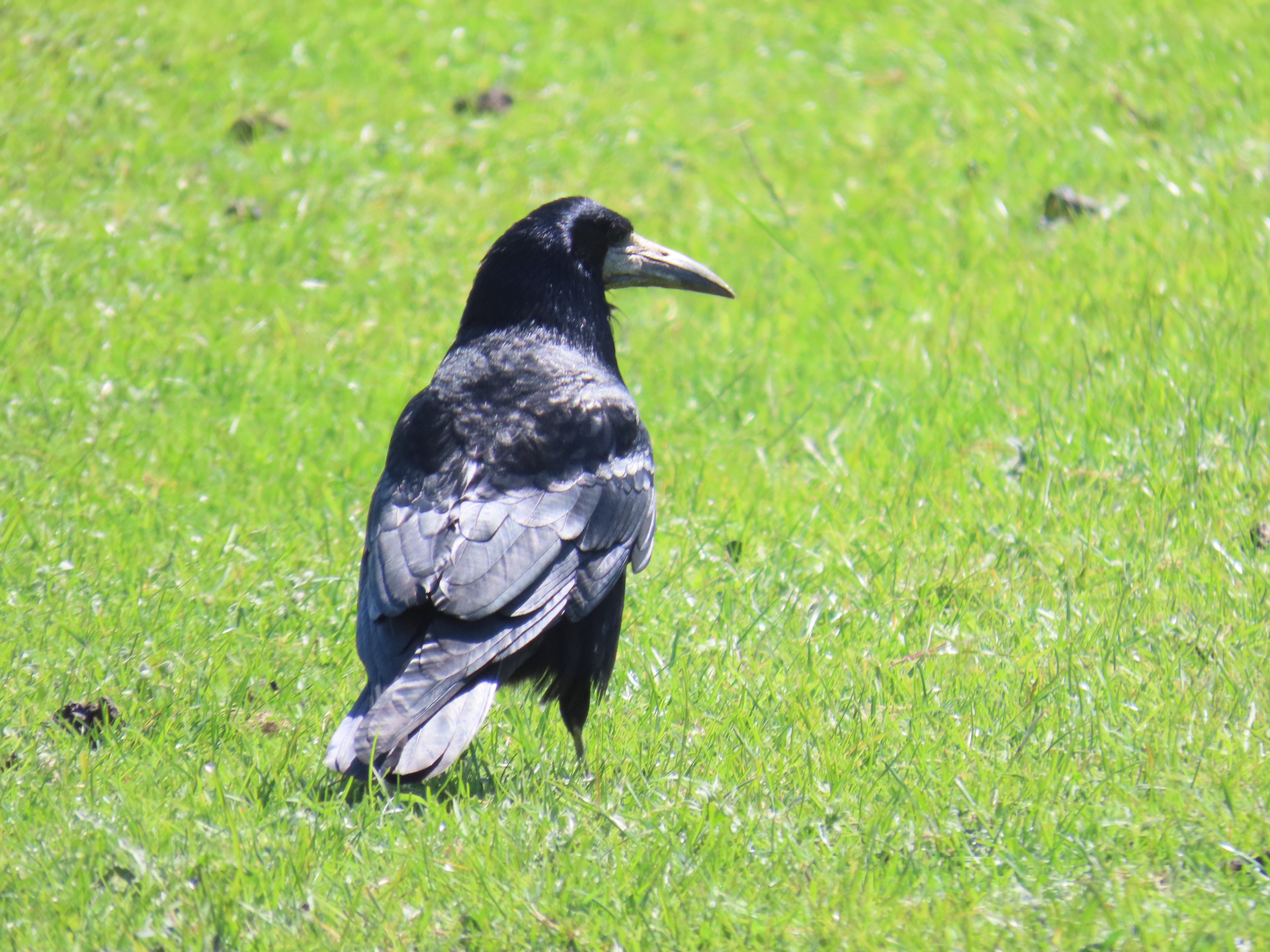
I return to the bus stop and watch the entertaining Rooks on the paddock. Young Rooks have fledged and demand being fed by their parents.

Adult Rook.
Young Rook.
Young pestering parent.
A demanding young Rook.

And what about the last interglacial? The Wolds would have certainly been wooded, but with large herds of herbivores there would have been much open grassland with trees and patches of closer woodland in places. Bison, Roe Deer, Red Deer, Aurochs and Giant Elk would have grazed and browsed the Wolds, the small Roe Deer the only remaining wild deer species in East Yorkshire. Roe Deer, which actually expanded across East Yorkshire area from the 60s and 70s, after being absent or very rare for decades due to habitat loss and poaching. Now it is a ubiquitous species, common even in suburban areas. Today's featured species though, was on the opposite side of the deer size scale...

Giant deer

The Irish Elk or Giant Elk, Megaloceros giganteus, is the largest species of deer to have ever existed. Although large numbers of complete subfossil skeletons were found in Irish peat bogs, the species was widely distributed across Europe and North Asia. Fossil remains were found at Kirkdale Cave, Victoria Cave, and at Sewerby cliff (unfortunately now lost!) demonstrating both its distribution in Yorkshire during the last interglacial, and also pointing at Cave Hyenas as their predators.

 Giant Elk from Leeds city museum.
My ink drawing of a Giant Elk stag during the rut.
Can I see them?

The Irish Elk became extinct 7000 years ago, with the last populations in the Urals of Western Russia. Their closest surviving relatives are Fallow Deer, which share their palmate antlers, and can be seen in some parks like Sewerby Hall and East Park.

Walk details. Distance: 13 km. Train to Driffield, bus 121 back from Burton Agnes to Driffield. Relatively easy terrain, with tarmac, country lanes and across arable fields. Vary little incline, with he minimum heitght is 14 m near Driffield, the maximum 25 m at Burton Agnes. There is a little cafe at Bracey Bridge for refreshments.

More information

Boylan, P. J. A new revision of the Pleistocene mammalian fauna of Kirkdale Cave, Yorkshire. Proceedings- Yorkshire Geological Society 43, 253–280 (1981).

Delany, M.J. 1985. Yorkshire Mammals. University of Bradford. 256 pp.

Lamplugh, G. W. Report on the buried cliff at Sewerby, near Bridlington. Proc. Yorks. Geol. Soc. 9, 381–392 (1887).