Tuesday 27 February 2024

Last interglacial coast trail. Stage 2: Cottingham to Beverley

It is a very cold overcast day, but I take the bus to the start point of the second stage of the Last Interglacial Trail at Northgate, Cottingham. The first part of the walk follows Park Lane across Cottingham Parks. It is hard to discern any trace of a cliff on the ground, but the fact that ditches run steeply to the east indicates I'm walking near the bottom of the cliff, not on the chalky old cliff, which is too permeable for running water. Here the old sea cliff lays buried by till and other glacial deposits. 

A ditch near Cottingham Parks.

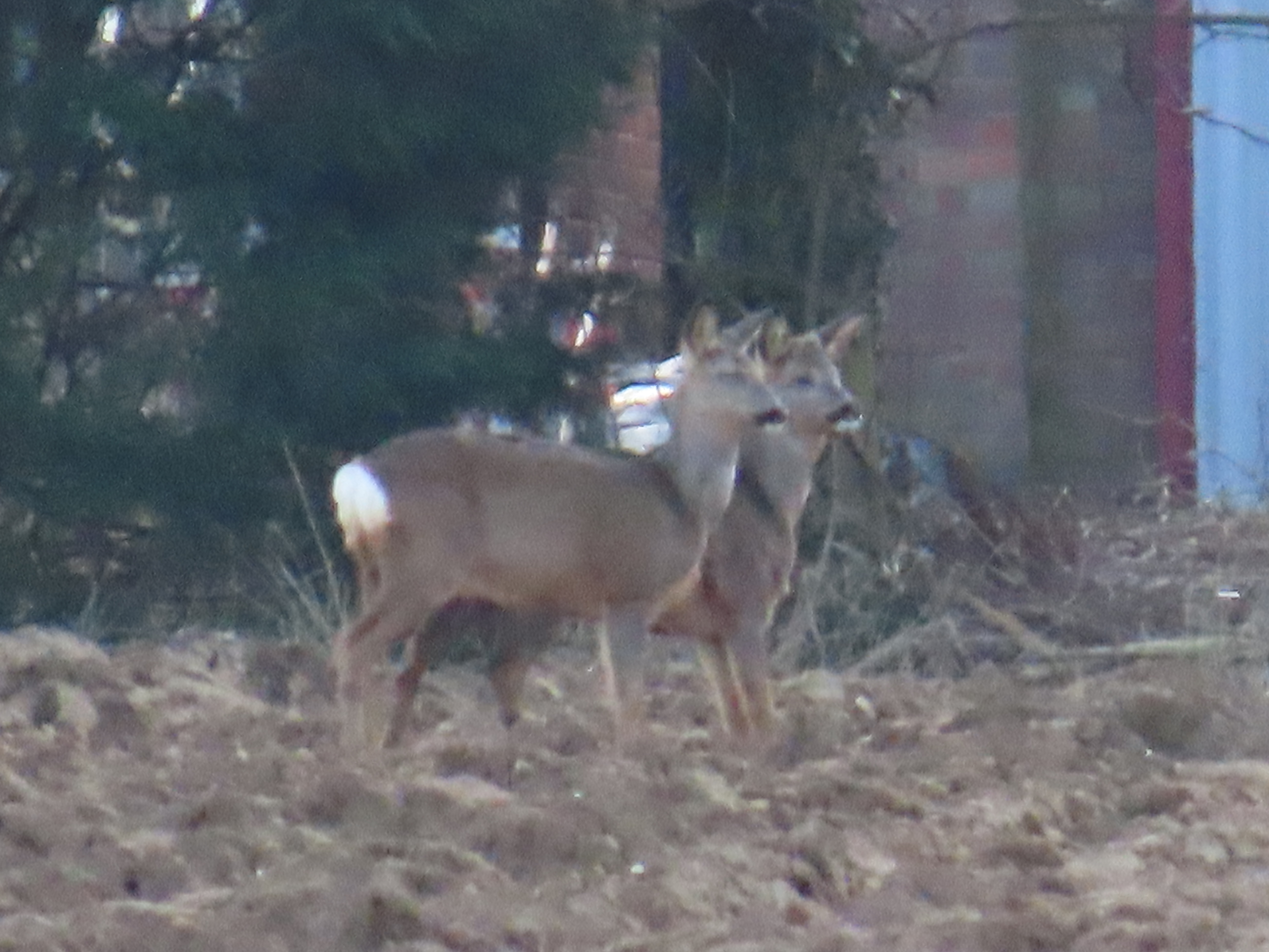
After walking on the surfaced road by a series of greenhouses I get to Burn Park Cottages and then Burn Park Farm, with its gnarled walnut trees. A very confiding Kestrel greets me on the ground and then on the farm sign (above). Chaffinches sing from the hedges.

Burn Park Cottages.

Flooded field at Burn Park farm.

I find the first Dog's Mercury of the year growing by a ditch on the eastern side of Jillywoods, together with the abundant Cuckoo's Pint, remnant plants of the northern woods of Cottingham.

A chalky path by Poplar Farm.

At Poplar Farm, seven Pied Wagtails feed on a flooded field. The paths have been very passable, only one section by a flood more muddy.

A road bridge crosses the A1079. Skylarks sing. The area is known as Beverley Parks, as there was parkland and a hall, White Hall.

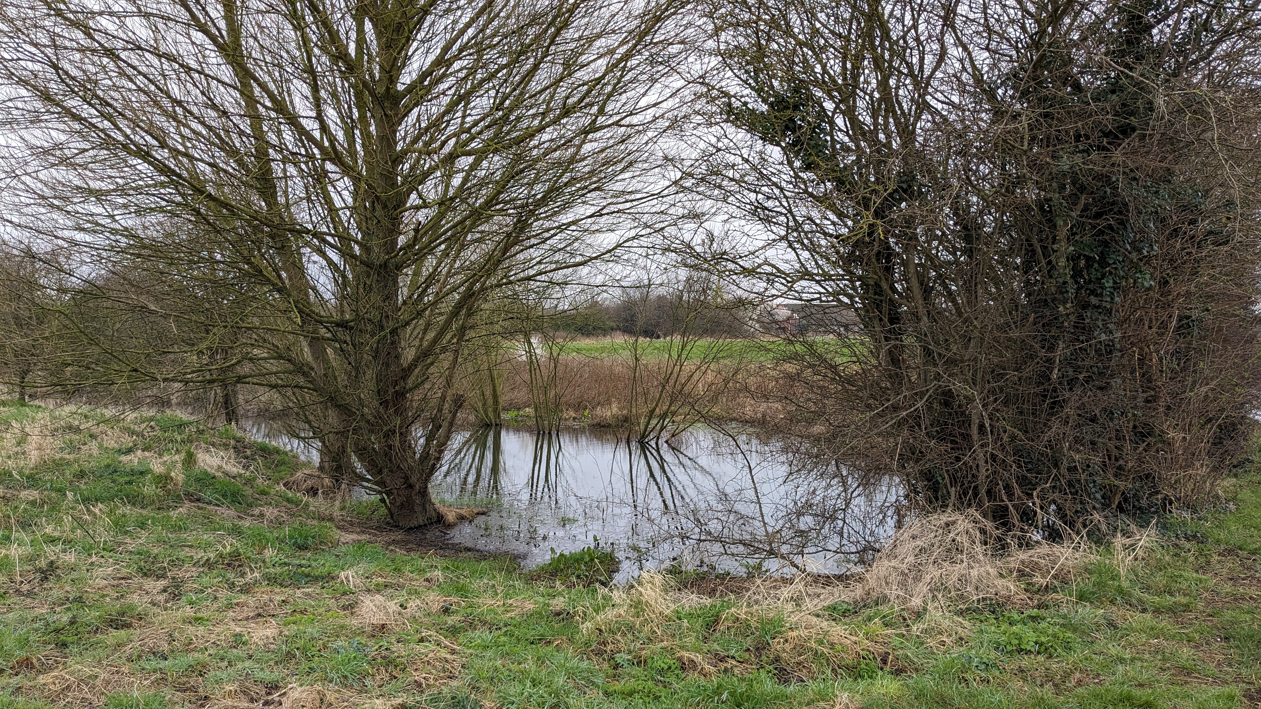
Pond at Beverley Parks. There are scattered ponds in this area that are actually springs. I wonder if these springs would have been under the sea of the Ipswichian or exposed on the shoreline.

A lone oak on the last fields before Beverley by Sheperd's Lane. This is a very rapidly developing area, the new houses in the background.

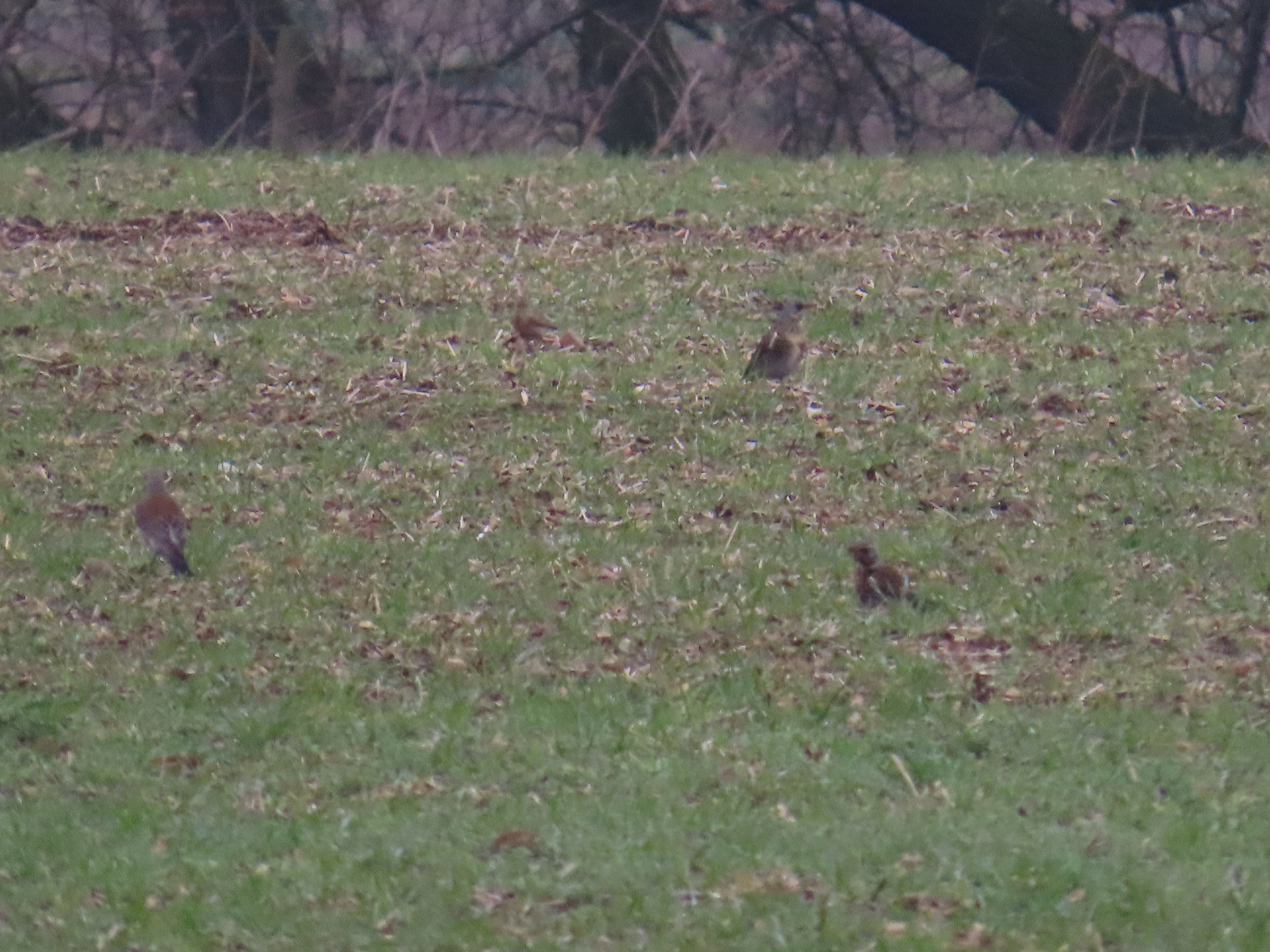
A large flock of Fieldfares

Rooks on roundabout on the edge of Beverley.

Willow Lane.

As I arrive to the end of the walk at Beverley Minster, the bells ring midday (a few minutes early, all to be said!), and I make my way to a cafe for lunch before taking the bus back home.

In contrast to today's quiet and relaxing walk, an amble in this area in Ipswichian times must have been terrifying, not least by the presence of Cave Lions and the other large carnivore of the time: Cave Hyenas.

No laughing stock: Cave Hyenas

Hyenas are an abundant and widespread component of the Ipswichian fauna. One of the key sites for British fossil hyenas is a Yorkshire site with outstanding archaeological and historical significance: Kirkdale Cave, near Kirkbymoorside. The cave was excavated in 1821 by Reverend William Buckland, having been alerted to the presence of fossils in the cave. An eccentric character, the first ever lecturer in Geology, and theologian from Oxford University, he approached the excavation and interpretation with sharp logic and innovative experimental approaches for the time. In a fascinating article on the cave, a brilliant example of paleontological analysis, he made a very good case that hyenas used the cave as a den, and the fragmented bones of a range of animals, including hippo, rhino, deer and elephant, amongst others, represented the remains of prey, having been gnawed by the powerful jaws of the hyenas. Buckland even made some experiments with a captive Spotted Hyena from a travelling zoo to test some of his interpretations regarding the fossilised faeces he found (he went on to coin the term ‘coprolites’ to refer to them). After feeding bones to the captive Hyena and examining its faeces he could conclusively determine that the coprolites belonged indeed to Hyenas. Hyenas had dragged hippo remains into their caves or the remains were found as part of their faeces.


A portrait of William Buckland. Public Domain.

From Buckland:
‘It must already appear probable, from the facts above described, particularly from the comminuted state and apparently gnawed condition of the bones, that the cave at Kirkdale was, during a long succession of years, inhabited as a den by hyenas, and that they dragged into its recesses the other animal bodies whose remains are found mixed indiscriminately with their own; and this conjecture is rendered almost certain by the discovery I made, of many small balls of the solid calcareous excrement of an animal that had fed on bone’ 
‘I do not know what more conclusive evidence than this can be added to the facts already enumerated, to show that the hyaenas inhabited this cave, and were the agents by which the teeth and bones of the other animals were there collected’


A Cave Hyena partial jaw from Kirkdale Cave at Yorkshire Museum, York. Yorkshire Museum Collection. Licence: CC BY-SA 4.0.

Another Yorkshire cave with Ipswichian deposits, and likely another hyena den at that time is Victoria Cave, near Settle. A similar fauna with Hyena, Hippo and Straight-tusked Elephants, and crucially, no evidence of humans. The time period where the deposits formed at Victoria Cave was dated by Uranium series to 120,000 years ago, similarly at Kirkdale Cave was dated as 121,000 ± 4000 yr BP, confirming their Ipswichian age. Modern hyenas den in burrows of other animals, that they enlarge, so the fact that they used these caves preserved a treasure trove of fossils of the fauna of the time. More exposed sites on plains and river terraces were subsequently erased by the last ice age.

Hyenas are a highly intelligent, social species with females being dominant to males. They live in clans of related females and unrelated males, and hunt cooperatively. Recent studies on Spotted Hyena indicate that they are more likely to hunt than to scavenge and they frequently lose prey to lions, although they also steal prey sometimes from lions too. Cooperative hunting allows them to be able to tackle large prey. Hyenas can commute long distances between their dens and feeding grounds, round trips of 80 km have been documented. So a trip of the Kirkdale clan to the Wolds wouldn't be out of the question.

One of the Spotted Hyenas at Yorkshire Wildlife Park by its den.

Where can I see them?

Cave Hyenas (Crocuta crocuta spelaea) were a subspecies of the Spotted Hyena, which became extinct in Europe c. 29.000 BP. Spotted Hyenas are currently distributed in Sub Saharan Africa. A presumed Spotted Hyena cave painting at Chauvet Cave has been deemed to be a skinny cave bear, although its legs look very hyena-like to me. A clan of Spotted Hyenas can be seen at Yorkshire Wildlife Park. Cave Hyena fossils from Kirkdale can be seen at the Rotunda Museum in Scarborough and the Yorkshire Museum at York.


Walk details. Distance: 8.3 km. Terrain: most of it flat, some on unsurfaced paths that can be muddy, the rest on tarmac. Maximum height 15 m, minimum 8 m. Start at Northgate, Cottingham, near Park Lane, end at Beverley Minster. A mix of town and rural landscapes, with arable and hedgerows and small wooded pockets and some ditches and drains.


More information

Buckland, W. Account of an Assemblage of Fossil Teeth and Bones of Elephant, Rhinoceros, Hippopotamus, Bear, Tiger, and Hyaena, and Sixteen Other Animals; Discovered in a Cave at Kirkdale, Yorkshire, in the Year 1821: With a Comparative View of Five Similar Caverns in Various Parts of England, and Others on the Continent. Philosophical Transactions of the Royal Society of London 112, 171–236 (1822).

Barnett, R. The Missing Lynx: The Past and Future of Britain’s Lost Mammals. (Bloomsbury Publishing, 2019). 352 pp.

Kruuk, H. The Spotted Hyena: A study of predation and social behaviour. (Echo Point Books & Media, LLC, 2014).

Boylan, P. J. A new revision of the Pleistocene mammalian fauna of Kirkdale Cave, Yorkshire. Proceedings- Yorkshire Geological Society 43, 253–280 (1981).

The discovery of the kirkdale cave. Natstand.

Sunday 25 February 2024

Alkborough Flats with Hull Nats


We were extremely lucky with our monthly field excursion at the Hull Natural History Society on Sunday: long sunny spells and barely a breeze. We gathered at the newly resurfaced bottom car park, donning wellies in expectation of flooded paths. Soon, we ticked Cetti's Warbler, a very vocal male was on territory at the pond by the sewage treatment plant. A distant cream-topped Marsh Harrier added the second speciality of the site. Some members were lucky enough to hear a booming Bittern near the main hide. We wanted to do the circular walk along the Trent bank, but the flood was impassable even with wellies, so we decided to head towards Tower hide instead.

Distant Marsh Harrier.
One of the highlights of the day was a large flock of several hundred Black-tailed Godwits, flushed by a Buzzard.
The flock of Black-tailed Godwits later settled on the flooded fields.
Distant Grey Heron and Little Egret. Later a Great White Heron was also spotted distantly from Tower hide.
One of three Buzzards soaring.
Male Grey Wagtail by sewage treatment plant.
Reed Bunting.
Stonechat.
Some of our party climbing the cliff, with the wonderful views beyond.
A pair of Roe Deer.
Bombus terrestris queen basking.
I was keen to tick the Water Crickets at Low Wells. Although present, they were in the form of tiny nymphs!
Those of us who stayed for coffee and cake at The Paddocks Tea Room were rewarded with wonderful views of a Barn Owl hunting along the floodbank.
Barn Owl.

Monday 19 February 2024

A walk up the River Hull in February


A sunny but breezy day, I walk to Oak Road and then up the river Hull until Wawne. There is an uplifting chorus of singing birds, including SOng Thrush, Robin and Wren

 
Song Thrush.
At the lake, I'm pleasantly surprised to find that the lone cob has got a new partner. The pen looks in much better condition than last year's one, which ended up dying after the cygnets hatched. The cob has raised three cygnets to fledgling. Last time I was here, a couple of weeks back, he was encouraging them to practice flying along the lake. A local told me he chased the young off last week.
The resident pair of Mute Swans at Oak Road Lake.
Three Cormorants resting on one of the fishing platforms. It is not possible to walk around the lake if you are not wearing wellies, so this area has far less disturbance than usual.
On the north side of the lake there is a small group of Siskins, feeding low down on the birches.
Three Buzzards are displaying high over Ennerdale. with some mewing.
Usual horse grazing on the river bank.

I check the reservoir. There are Shovelers in the distance. Little Grebes duet their little chortle. The usual assortment of waterfowl are present. It is after I carry on by the river when I come across this cormorant, which emerged from the water having captured an eel. The eel was putting some fight and the cormorant struggled to position it right for swallowing. In the third photo, the cormorant has thrown the eel into the air to catch it by its head, the threads of mucus between the eel and the cormorant are visible. Usually cormorants dive as soon as they see people on the bank, but in this instance it was too busy with the eel to pay me any attention. Once swallowed, it dived immediately. Nice to see there is still an eel population in the River Hull (despite the cormorants!).


Cormorant with Eel.
Soon after I cross Reigh Carter Way, I can hear the Skylarks singing from the fields. There is a lot of activity, with chasing between individuals.

Skylark.
A view of the very high River Hull.
Reed Bunting trying to hold onto the branch against the wind.
I'm very pleased to see two Lapwing on the flooded fields, within the Hull city limit.
Lapwing.
Lapwing.
A Mute Swan near Wawne, one of a pair, drying its foot before tucking it in.
Rook.
Male Stonechat by river bank near Dunswell.
The river arriving to Wawne.

Monday 5 February 2024

Last interglacial coast trail. Stage 1: Hessle to Cottingham

A cloudy and windy morning, but I feel like I need to make a start on the trail. This is the first stage of a new trail I've planned for this year, which I called the Last Interglacial Coast Trail. For more info and background on the trail go to the linked page. I had planned to get the train to Hessle, as its station is linked to the topic of the trail, but there is strike action today, so I opt for the bus and walk to Hull Royal Infirmary to take bus 350 to the Humber Bridge. I get there just after 9 am. I'm keen to visit the visible cliff at Humber Bridge Country Park (top shot). This is the result of quarrying, but it gives an idea of the height of the cliff as it must have looked during the Last Interglacial. 

Some Wigeon squabbling by the Humber.

It has just been low tide and the wind is ruffling the Humber. As I walk under the Humber Bridge, a group of Wigeon on the shoreline are finding it hard to avoid the waves of pink-brown water. During the last interglacial, the Humber mouth was here. It was a clear estuary as there was no Holderness clay constantly feeding onto it as a result of erosion. It is likely that saltmarsh would have formed here, sheltering the cliff to some extent, although the cliffs would have been exposed to erosion at high tide and during storms. The cliffs are not as high as those in Flamborough, maybe just 20 m high, the low Lincolnshire coast visible across, and the open North Sea, the then Bay of Holderness looking east. I'm not going to see much of the sea until I get to Bridlington later in the trail, so I linger, despite the stiff wind.

Walking under the Humber Bridge.
The Hessle Exposure is on the left of the railway line by the bridge, now covered by thick vegetation. Hessle Train station is in the distance.

One of the two exposures of the buried interglacial cliff is the Hessle exposure. This is located by Woodfield Lane, just by the bridge over the railway line near the station. I make a stop to look from the bridge (above). The exposure was first noted in 1825. Excavations took place when the railway line and bridge were constructed and during further roadworks that exposed the cliff, the last in 1983, where the site was visited by members of the Hull Geological Society. Most of the mammal fossils collected at the buried cliff ended up at Hull Museums, but were sadly lost during the war. Horse was one of the most abundant fossils, which suggested that the fauna belonged to the end of the interglacial, when conditions had started to become cold again. The location of the Hessle buried cliff is shown in a diagram by Walton, limited by the chalk pits in the town, where the chalk is close to the surface at the top of the cliff, and the sands and gravels, that are present beyond the cliff, laid during the glacial and subsequent postglacial period. I have myself plotted the location of chalk pits to help place the western limit of the buried cliff to map the walk.

I carry on due north by Woodfield Lane, Hessle, slowly climbing in height. It is an affluent area, with large houses with long drives and mature trees. Much more wooded than the wider area. From the college there is an expansive view towards the East. It would have been all the blue open sea to the horizon, the smell of the seaweed on the strandline brought in by the breeze.

I cross Boothferry Road and then walk north along Jenny Brough Lane. The line of houses end at a farm, and the highest point in the stage, 40 m. A few horses are grazing on the paddocks, with Blackbirds and Redwings. The path turns east, following a boundary between the paddocks and some ploughed and fallow fields, with hedgerows protecting me from the wind. Two Skylarks sing and chase. A Buzzard flies up the hill, against the wind, mobbed by Crows. A man scans a field with a metal detector.


Buzzard
Spot the Skylark.

I'm getting now to Tranby Croft, which used to be a large country house and state. The tower building is most impressive. I walk along Tranby Ride and make my way to Kirk Ella by Woodland Drive, Mill Lane and School Lane. Soon, I am at St Andrews church, Kirkella. The area has many historic buildings.

Tranby Croft Tower.
A historic building at Kirkella with a Giant Redwood.

I make a quick stop for a hot drink at Willerby. Jackdaws call from chimney pots. After a little while I read Willerby Low Road, a quiet rural road.

Jackdaws.
Bullfinch.
A tractor flailing the hedges.

My first Fieldfare of the year, one of a dozen or so feeding with Starlings by Willerby Low Road near Cottingham.

The exact position of the coastline is known where borehole data has been obtained. One of these locations is at Harland Way, Cottingham. The steep incline of Harland Way, which is familiar to anyone who has cycled to Skidby Mill, is also a cue to the location of the cliff. Given the uncertainty, this is not strictly a 'coast' or a 'cliff-top' walk, given the location of the cliff line is imprecise. The low cliffs would have been 5 to 30 m high, but in some areas the bedrock would have been low-lying and covered by sediments or dunes or protected by saltmarshes, so a strict cliff may not have existed all the way. Ravines and rivers would have flowed to the bay and mudflats would have been exposed at low tide. 

After crossing Eppleworth road and Cottingham Cemetery, I reach Harland Way, I walk to the bus stop to get bus 104 back home in time for lunch.

Displaying hippo.

Humber Hippos

It might be surprising, but the past existence of Hippopotamus in Britain is well documented, with fossils found in Wales and across southern England as north as Newcastle in several interglacial periods for the last million years. Eltringham put it quite graphically: ‘most of the rivers in southern Britain were swarming with hippos, much as the African rivers are today’. The hippos from the last interglacial belonged to the same species as today’s African river Hippo, Hippopotamus amphibious. They would likely have shared similar behaviour and habitat: they’d wallow in slow flowing water during the day in noisy herds, and emerge to feed on nearby grasslands at night, following well-trodden trails. Although hippo fossils from Trafalgar square are the most famous, Yorkshire fossils are surprisingly plentiful. They have been found in Kirkdale Cave, Sewerby Cliff, near Pickering, Leeds, and Victoria Cave, confirming that they did roam on all the major river basins in the region, including all the tributaries of the Humber. Both Kirkdale Cave and Victoria Cave were hyena dens, and the hippo fossils there, mostly teeth, belonged to young hippos, indicating that even this very large animal fell prey to hyenas (and likely cave lions too). The presence of hippo fossils in a site is a good indication of mild winters and warmer climate than we have today. The Humber with its main tributaries the Ouse and the Trent, would have been a hippo hotspot. The Driffield area with its braided delta, and the lower reaches of the Gypsey Race by Bridlington would also likely have held some hippo schools.


The Armley hippo.

Where can I see them?

Hippos became extinct in Britain at the beginning of the last glacial age, but the same species lives now in Sub-saharan Africa, and hippos are kept in many zoos in the UK. At Armley, Leeds, remains from three or four individuals were found in gravels left in a previous river terrace by the river Aire, currently on the north side of the Armley Gyratory. If you would like to see original fossils the Leeds City Museum has a mounted partial skeleton of the Armley Hippo (above), and a modern hippo skull.

Modern hippo skull at Leeds City Museum.

If you don’t want to travel far, how about a walk to Albany Street of Spring Bank, where you can pay your respects to a sculpture in honour of Bucheet? Bucheet was the first hippo that made it to Hull in modern times, and was one of the last exhibits as the zoo closed shortly after. London Zoo acquired a hippo in 1860 named "Bucheet" Bucheet was exhibited around the UK and spent a few weeks in Hull before being shipped via Liverpool across the Atlantic. It is regarded as the first hippo in North America. Bucheet had a short life, a young hippo when captured, he died in a Canadian circus in 1867. In the wild, hippos can live into the early 40s.


Walk details. Distance: 12.5 km. Terrain: light inclines, some steps at the country park, much of it flat, on tarmac. Maximum height 40 m, minimum sea level at Hessle Foreshore. Start by the Humber Bridge, Hessle, end at Harland Way, Cottingham. A mix of urban and rural landscapes, with arable and hedgerows and small wooded pockets.

More information

Eltringham S.K.1999. The Hippos: Natural History and Conservation. Poyser 184 pp.

Fenton, K. The Hessle and Sewerby Buried Cliffs

Catt, J.A. and Penny, L.F. 1966 The Pleistocene Deposits of Holderness Proc.Yorks. Geol.Soc. 35: 375-420.

Walton, F. F. Some Sections in the Hessle Gravels. Proc. Yorks. Geol. Soc. 12, 396–407 (1894)