

Almost the first thing I did was to flush a Kingfisher from a drain by the farm. Then two Mandarin ducks fly over, which is a surprise. I walked to the pumping station first. Two pairs of Mute Swans swim on the drain (top shot), sheltered from the wind. One of them seems to have a nest, but I can't see any eggs. There is a family of Greylags with three young. They look at me nervously.

Then a Cuckoo flies from just ahead of me from the side of the drain. My first cuckoo of the year! It remains silent and flies to a bush where it is promptly mobbed by Meadow Pipits and forced to move on.

The stages of reclamation of Sunk Island.
From reclamation to realignment
To give an idea of the zeal of the reclamation enterprise until very recently, engineer James Creassy wrote in a 1797 report for the draining and improvement of Keyingham Level:
'of all the improvements this country can boast none are so strikingly great, or of such public utility as gaining lands from the sea, and draining fens, swamps, and drowned lands.' June Sheppard added 'If the salt-marsh that extends between Sunk Island and Spurn Head should be reclaimed on some future occasion, further adaptations of the Winestead drainage will become necessary.' Little would these authors imagine that reclamation would stop and managed realignment start! Indeed, the easternmost corner of Sunk Island, 54 ha by the pumping station, has already been realigned. After removing rock gabions, the whole of the old wall was reduced in height and on 26th June 2006 two breaches were made. This was the last field to be reclaimed from the Humber, the land had beed arable for less than a century. The realignment scheme was compensatory habitat for development elsewhere. There are ongoing plans for a extension of this scheme at the stage of planning permission, to the east and west of the current site. This may mean the area will be returned to the tides of the Humber once more.

Pumping Station.

This is the outflow of the Winestead drain, called Patrington Channel across the marsh at low tide.

I watch the new realignment, the Outstray, now covered in salt marsh. The Cuckoo flies along the shore, giving me a brief photo opportunity.


I climb and follow the permissive path along the new sea wall, walking east towards Hawkins point. A little further ahead there is a monument on the sea wall to celebrate the raising of the bank and the position of the Greenwich meridian (more info here).
A small group of Brent Geese takes off, leaving a lone one behind. There are scattered Shelduck feeding on the marsh.


The plaque marking the location of Greenwich Meridian.

A little while ahead, on the wall, there is an odd object that looks like an old bomb on the sea wall, decorated with a plastic flower. Andy Gibson pointed out it is simply a metal float.

A view of the salt marsh towards the east.

Scurvy grass, Cochlearia officinalis, flowering profusely on the marsh.

This small beach in front of the sea wall gave me some respite from the wind.

Whole areas of the beach are made of small shells, which are also abundant in the mud by the wall.

One of at least 4 Wheatears on the rocks of the sea wall. Due to the wind, photography was challenging to say the least!

Little Egret.

A distant Whimbrel.

Pair of Roe Deer on the 1897 old sea wall, maybe the same as last week?

Before turning back, I have lunch sheltered behind a spit made of rocks, rubble and mud overlooking Hawkins Point. The tide was out and the waders distant.

Curlew, Grey Plover - some in summer plumage - and Dunlin feed on the mudflats.

A statuesque clump of mud left by erosion of sediments in this part of the Humber. A couple of sections of the sea wall have fallen through, despite the protection of rocks.
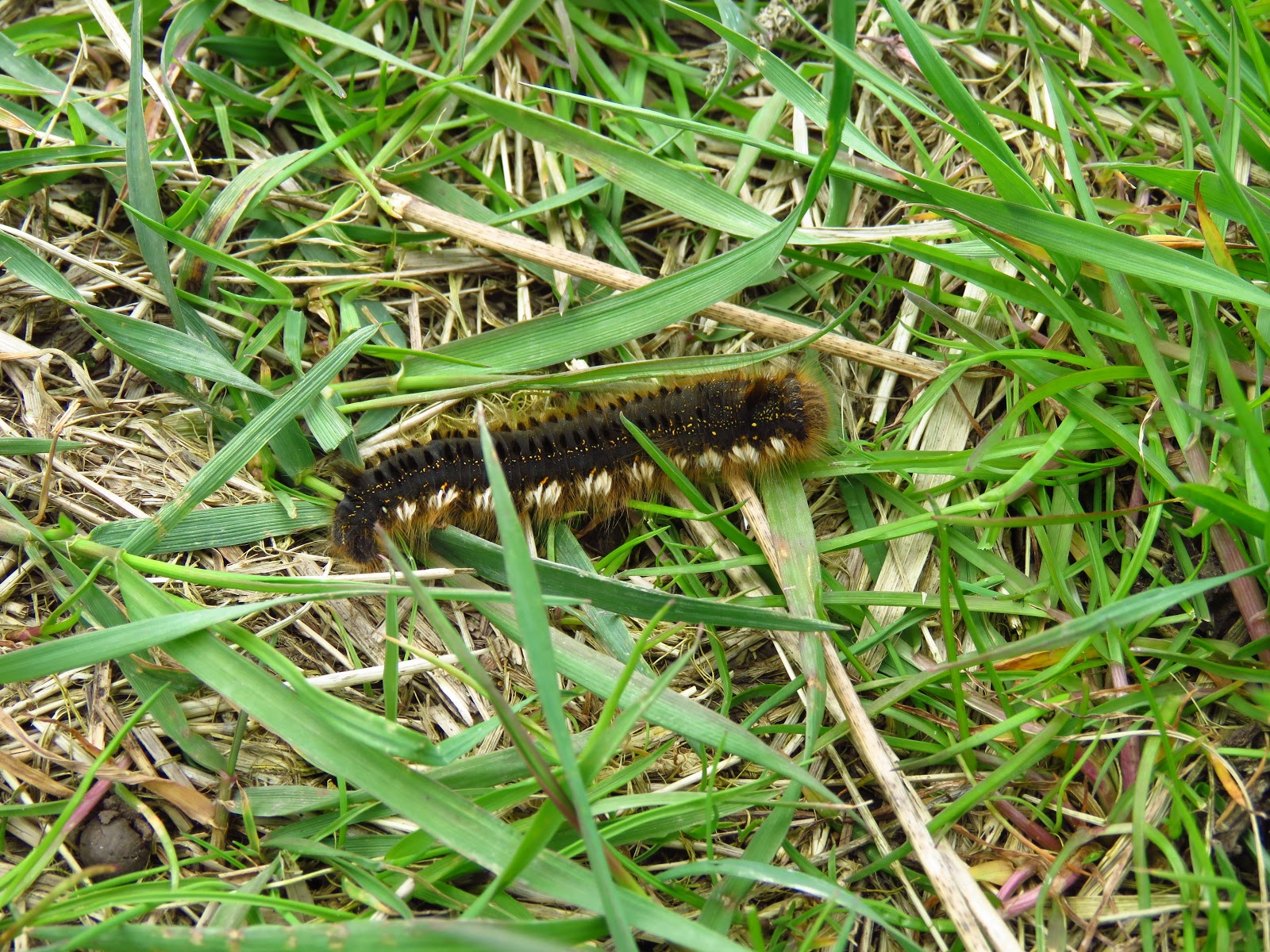
Drinker Moth Caterpillar, Euthrix potatoria.

One of a few queen bumblebees on the wing, a Buff-tailed bumblebee Bombus terrestris.

The Rapeseed in full bloom at Newlands Farm.

The bubbling calls of two Whimbrels alert me to their presence on the Outstray mudflats.

A male Marsh Harrier flies low over the rapeseed. The female was mobbed by a crow earlier and she moved onto Welwick Saltmarsh, while the male played with the wind flying up and down.

Featured bird: Dark-bellied Brent Goose
This small migratory goose winters in the east and south UK coasts and breeds in the Russian Arctic. It favours estuaries, where it feeds on the salt marsh and also upending in shallow water. It is an amber listed species, and suffered strong declines in the Humber in the mid 20th century due to the collapse of their main food, Eel Grass (Zostera), but populations have recovered in the last decades. In 1975 Eel Grass meadows reappeared in Spurn and Brent Geese started to increase in numbers. The Humber is now an internationally important site for the Dark-bellied Brent, with about 4,000 estimated, mainly in the outer Humber, of which about 1000 winter at Spurn.

More information
Sheppard, T. 1912. The Lost Towns the Yorkshire Coast and Other Chapters Bearing Upon the Geography of the District.
Sheppard, J. 1966. The Draining of the Marshlands of South Holderness and the Vale of York. (East Yorkshire local history series, 1966).
Welwick managed realignment white paper by ABP. Here.
UPDATE 1/05/2018. Thanks to Andy Gibson, who helped with finding a good starting point for this walk and also provided info and corrections regarding an error in the post on the elimination of the whole sea wall at the managed realignment site. I have edited the sentence and added some info of the strange metal object, which is a metal float.
This small migratory goose winters in the east and south UK coasts and breeds in the Russian Arctic. It favours estuaries, where it feeds on the salt marsh and also upending in shallow water. It is an amber listed species, and suffered strong declines in the Humber in the mid 20th century due to the collapse of their main food, Eel Grass (Zostera), but populations have recovered in the last decades. In 1975 Eel Grass meadows reappeared in Spurn and Brent Geese started to increase in numbers. The Humber is now an internationally important site for the Dark-bellied Brent, with about 4,000 estimated, mainly in the outer Humber, of which about 1000 winter at Spurn.

Today's walk, about 10 km round trip.
More information
Sheppard, T. 1912. The Lost Towns the Yorkshire Coast and Other Chapters Bearing Upon the Geography of the District.
Sheppard, J. 1966. The Draining of the Marshlands of South Holderness and the Vale of York. (East Yorkshire local history series, 1966).
Welwick managed realignment white paper by ABP. Here.
UPDATE 1/05/2018. Thanks to Andy Gibson, who helped with finding a good starting point for this walk and also provided info and corrections regarding an error in the post on the elimination of the whole sea wall at the managed realignment site. I have edited the sentence and added some info of the strange metal object, which is a metal float.


